
Anyway, putting the heartache to one side, what about the walk? At just under 6 miles, one of the shortest ones we've done recently. However this was definitely a case of quality over quantity as it was a route enjoyed by all. The weather was ideal and our track, starting at Merrivale, took us down the Walkham Valley to Criptor and then onto the mineral railway around King Tor and back to our starting point via the stone rows on Longash Common.
 |
| For those who want to know, our route for the day and its elevation profile. |
 |
| The view from our starting point, looking towards the old granite quarry at Merrivale and the three Staple Tors in the background. |
 |
| The first mile or so was along a very old carter's trackway, emerging from the woods into more open land via this evocative gateway. |
 |
| An old oak tree looking as if it's holding back the rocks. |
 |
| Our route took us towards Criptor, coming from Daveytown to the right. |
 |
| Looking towards the long-time defunct Swell Tor quarry, the entrance to which has been gouged out of the rocks at the top of the hill. Stone from here was used for Nelson's Column and London Bridge (more of that later). |
 |
| A few corbels short of a bridge? - surplus corbels left in place after the 1902-04 widening of London Bridge (opened 1831), this was the bridge sold in 1967 to an American. It has been said that while there were a dozen corbels originally, a few were sent as spares to America when the bridge was moved. |
 |
| Around 1699/1700 an Act of Parliament dictated that waymarking stones would be put in place to trace the route of the trackway linking Ashburton and Tavistock, two stannary towns. A few of these remain and they are recognised with an A on one side and a T on the other. |
 |
| One of the larger cists/kists/kistvaens we've encountered. The capstone was split by a farmer in the past and a large piece extracted for a gatestone. It can be found quite close to the very impressive double stone row at Merrivale. |
 |
| We do like a bit of historical enactment and here we are reconstructing a Bronze Age burial. Oh, how empty the house seems without my IWC. |
 |
| And here's another cist. This one is smaller than the one above but it is a goodie because you can see the circle of stones that surround it and get a good feel for how it would have been built up and covered with soil/turf. |
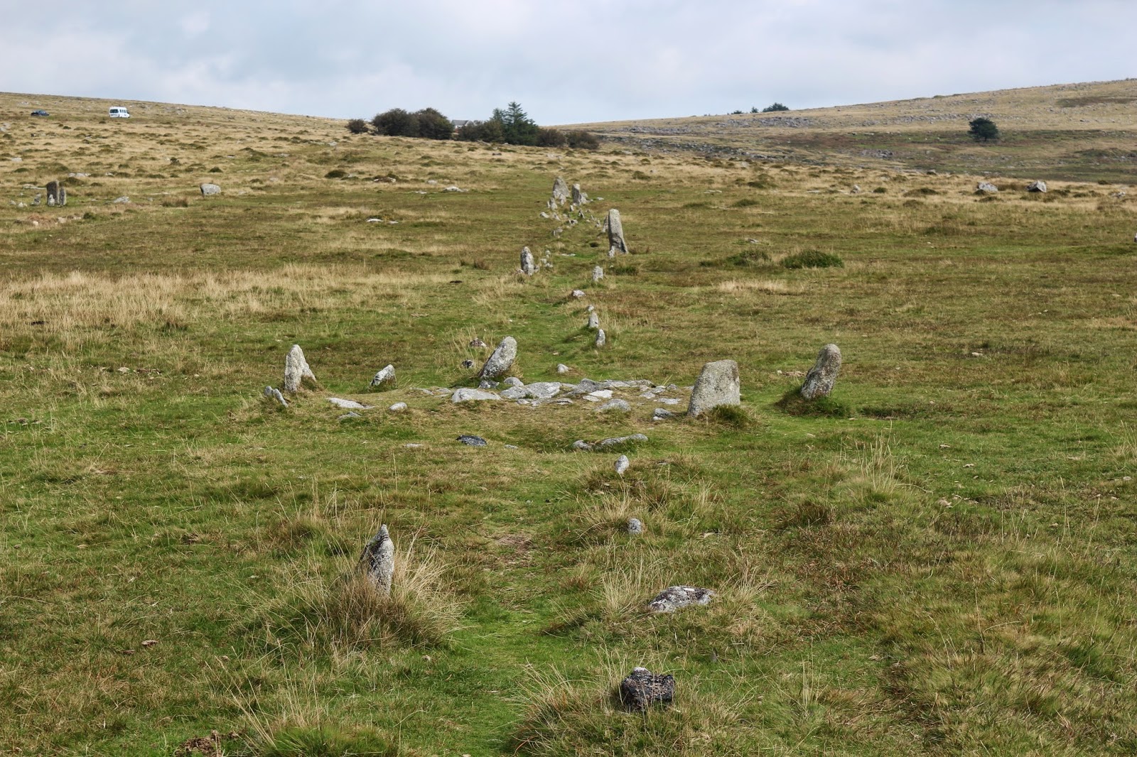 |
| The relationship of the circular cist with the stone row (which is about 1/2 mile long) suggests that whoever was originally interred was of 'high status'. The much larger cist is just off to the right. |
 |
| There's always something to be seen on Dartmoor. This is a photo of a large granite block split in situ but never taken away. The drill marks can be seen and, in my humble opinion, the piece to the right would make a great gatepost. A lot of labour was involved and it seems a waste for it not to have been used. |
No comments:
Post a Comment