 |
| We started and ended just off the centre of Callington on the old Liskeard Road. A short walk of just 4 miles, which fitted in with our timetable for the day very nicely. A mixture of quiet lanes (aren't they all around here), footpaths and tracks. A few hidden places were passed through. |
 |
| This really is a wonderful time to be out and about. Lots of foxgloves out in the hedgerows. It seems to be a good year for them. |
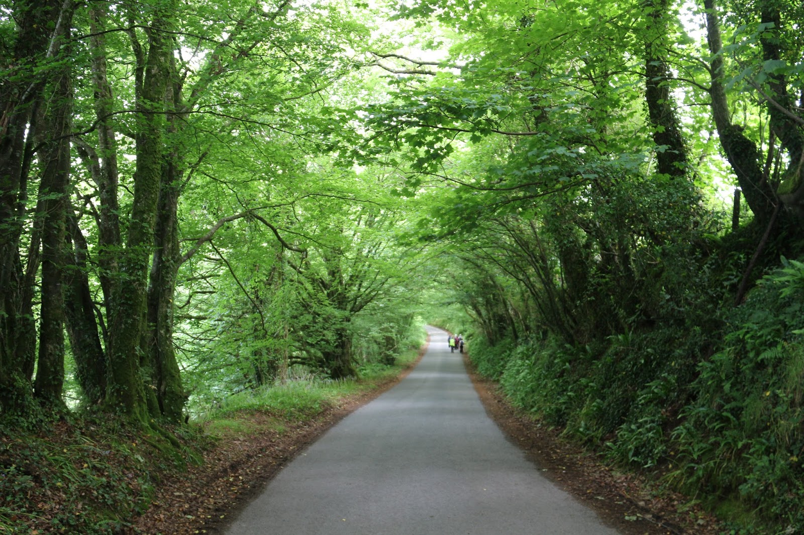 |
| Walks at this time of year are always enhanced by the green canopies almost forming tunnels through the trees. |
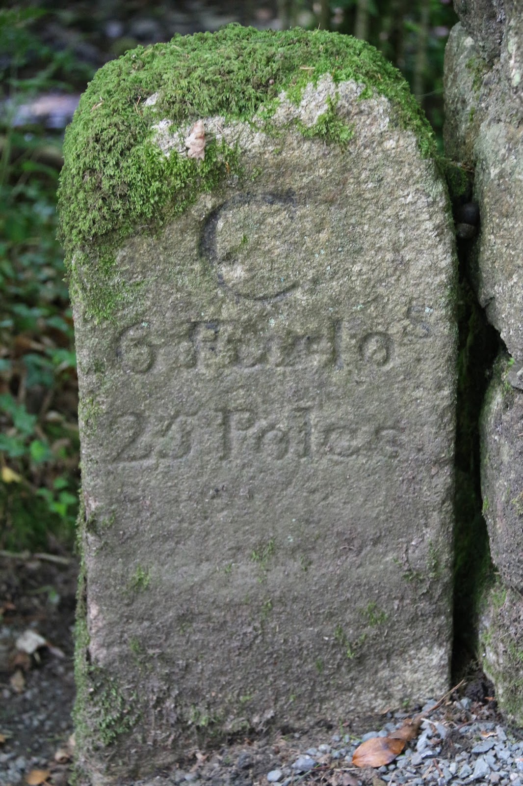 |
| Down near Bearland Bridge this milestone is interesting in that it shows the distance to Callington as 6 furlongs and 25 poles, which is quite an accurate measurement for a milestone (maybe that's a misnomer? Perhaps it should be a furlongstone?). Just in case, you've forgotten there are 8 furlongs in a mile and 40 poles to the furlong. A pole, also known as a rod or perch, being 5.5 yards. I suspect, but don't know, that this lane was once-upon-a-time a main route between Callington and Liskeard, hence the distance marker. |
 |
| Just over the bridge is this parish boundary marker - to the left is South Hill and to the right is Callington. I would guess that the stream itself, a tributary of the Lynher, is the boundary between the two parishes. |
 |
| Haye Farm, once a mill but now the home of a therapeutic community. The overshot water wheel to the right, fed by a wooden launder, is used to generate power. It is supplemented by an impressive array of solar panels just out of shot. The water itself is taken off the stream by a leat which is about 3 furlongs in length. |
 |
| The ability of trees to produce callouses in response to a foreign body, in this case barbed wire, never ceases to intrigue me. It looks like the callous embraces two trees. |
 |
| A green lane linking Haye Mill to Frogwell. |
 |
| Shades of fresh green on a sycamore tree. |
 |
| Looking north-west towards Bodmin Moor, with Caradon Hill to the far left and Sharpitor to the right. |
 |
| Looking south-west with Cadsonbury Hillfort in the centre. It's an Iron Age hill fort, dating from the 3rd and 4th centuries B.C. It is thought that there was no permanent settlement on the hill top: the people lived close to the River Lynher for water supply, and moved up to the fort when danger threatened. Technically the fort is classed as a Defensive Earthwork with Single Banks. |
 | |
| This post was not meant to be a guide to milestones around Calling but here's another one. This was placed in position by the Callington Turnpike Trust formed in 1785. A letter to the "Gentleman's Magazine" in 1754 called the roads in Cornwall the worst in all England. To remedy this problem turnpike trusts were empowered to improve the local roads and charge tolls for their use. "The West Briton" reported the good people of Callington in ecstacies when the Callington Turnpike Trust was abolished in 1874, removing what they considered to be a levy of blackmail on their travels. This milestone, just to the south of the centre on the old Liskeard road, records that it is 4 1/3 furlongs (what an odd unit) to Callington market gate and 8 miles to Liskeard. The arrow shows that the stone was also used as a reference point by the Ordnance Survey. |
 |
| Many of the fields around us are enshrouded with plastic 'cloche' which brings the maize crop on more quickly. Some say it allows harvest a few weeks earlier than with conventional cultivation and gives the chance of another crop being sown before the end. Although it looks pretty stark at the moment, it doesn't take long for the maize to push through and hide the biodegradable.plastic with its growth. |
No comments:
Post a Comment