Tuesday 25 July 2017

Back on Dartmoor after a long break

It seems ages since we've walked on Dartmoor so it was a particular delight to head to the south east area of the moor to 'bag' a few tors - four on this route. And weren't we lucky with the weather? A day later and we certainly would not have ventured out onto the open spaces for fear of being washed away.
The starting point for our walk was the Cold East Cross car park,  few miles north of Ashburton. From there we headed south to Buckland Beacon, west to Bowden Farm, then north-eastish to Blackslade Ford, north to Pil and Top Tors, east-ish to Rippon Tor and then south-westish back to the car park. Almost bang on 6 miles, with a few lumps and bumps - after all we were on one of the highest parts of the moor. A great route and great weather.

Wherever you walk on Dartmoor, you are never far from a carved stone. These can be milestones, boundary stones, estate markers or water company catchment areas. And more. This one was quite close to our starting point...
...and is marked, not that clearly, with the letters EPB. EPB? Work that out. No, not the initials of contiguous parishes but the initials of Edmund Pollexfen Bastard. The Bastard family purchased the manor of Buckland in 1614 and in 1837  a series of boundstones (boundary stones) were set up by Edmund to mark the limits of his estate.
A rather fine looking Dartmoor pony, enjoying being photographed. The ponies on this side of the moor seemed to be of purer stock than those we see on the west moor. But what do I now about horses?
And then it was further south a mile or so to Buckland Beacon. As the name implies, it was, and indeed still is, the site of a beacon. This was one of the beacons used to signal the arrival of the Spanish Armada in 1588 and it has been used for other celebrations ever since, including the Millennium and the Queen's Jubilee. The Ten Commandment Stones sit at the base of the beacon and have weathered a bit since they were carved in 1928, commissioned by the then lord of Buckland, Mr William Whitely of Wellstor. They were carved by W.A.Clement to celebrate Parliament's 1928 rejection of a new Book of Common Prayer. There has been some restoration work done on them recently by the Dartmoor National Park Authority and this has been featured on local TV and radio, which might explain why there were quite a few (well, six!) other people there at the same time as us.
Some serious stone-walling on either side of the green lane leading from Bowden Farm up onto the moor. For many generations this track has functioned as a drove road for farmers bringing their stock up to graze on the high pasture from further down the valley around Buckland-in-the-Moor.
The cluster of buildings which make up Bowden Farm. It's a long-house, with a cross passage separating the people (under the thatch) from the animals down the slope in the rest. There's clearly been some modifications made and additions built on but the core of the mediaeval farmstead can still be discerned. The owner told us the building dates from the 14th century but the site is mentioned in the Domesday Book.
An unusual copse of pine trees close to Blackslade Ford was an ideal place for our lunch stop. In the sun and out of the wind.
On the top of Pil Tor. Effectively two granite peaks separated by an expanse of grass. Unusual but not unique.
The view from Pil Tor to the north-west, with the spire of Widecombe-in-the-Moor church down below.
Kim, our butterfly expert, trying to spot what's flying around. The answer? Not a lot as it was too breezy.
Looking north-east with Haytor to the left and Saddle Tor to the left. We've 'done' both of these in the past and it's probably time for a revisit.
Looking south-east from Top Tor towards our next target, Rippon Tor. Down to Hemsworthy Gate and then a bit of a slog up to the tor.
The top of Rippon Tor is another great place for views. This is looking south towards the Teign Estuary, with Teignmouth just discernible in the far distance.
A final oddity on Rippon Tor before we descended to our starting point, detouring on the way on a fruitless search for the Nutcracker Stone - a Logan or wobbly stone used by the locals to crack nuts (Really! That's what the legend says)). We couldn't find it as it had been blown up a long time ago but it's still marked on the map. And the oddity? An unfinished grindstone shaped in situ but never completed.


Saturday 22 July 2017

Another stretch of the Cornish Coastal Footpath done

Slowly but steadily we are ticking off the miles of the Cornish Coastal Footpath. Here's another piece of the jigsaw completed. Our aim is to complete what we have left to do by the end of this year. I'm feeling optimistic.
Our route was along the coast from Seaton to Looe, just under 5 miles and, although not too onerous, was a good exercise.
Our starting point was just by the beach in Seaton (Seaton, Cornwall, that is, not Seaton, Devon). Not a sandy beach but it's a good place for families as there's a river running onto the beach and the parking is easy. It never seems to be over-crowded.
The first half mile or so was uphill, leading to this flight of steps into the woods. As always, all distances on finger posts are best regarded as being approximate.
Looking due west towards Looe Island in the mist and our destination, Looe, directly opposite on the mainland. Luckily the weather brightened up from this point and we were not troubled by overcast skies.
A field of barley shimmering in the breeze. A few more weeks of sun and the crop will be ready for harvesting. I wonder if the growing number of micro-breweries in Cornwall is leading to increased acreage under barley? 
A female Meadow Brown butterfly, looking rather faded. Lots of these around but few had the decency to stay still long enough for me to get a photograph.
And the same applies to this male Gatekeeper, who steadfastly refused to open its wings fully. But I could see the characteristic two white spots and the broad markings on the forewings that help with the identification. The Gatekeeper is one of the short-tongued feeders, so called because its proboscis is relatively short and they can only feed on flat flowers. Fascinating, eh?
A pedant would argue that the grammar of this sign is incorrect. The grammar of that sign is incorrect, say I. There was no chicken crossing when we were there. Perhaps one had crossed just before we arrived and maybe one would be crossing after we left. But definitely nothing crossing at the time and we did keep an eye out for it, just in case we squashed it with our heavy boots.
There was about a 1/2 mile diversion of the footpath inland and this sign explains why that was. Erosion and slippage are not uncommon and it must be a constant challenge for those who have to realign the route, particularly negotiating with landowners for access rights. It's a pity that this diversion was where it was as it meant that we could not walk on the cliff below the Monkey Sanctuary. Yes, there is one and it has been there for at least 40 years. I was hoping to be able to photograph a 'Beware of the Monkeys' notice but it was not to be.
A pirate waiting for a bus. Looks like there hasn't been one for a while. Actually, he was sitting guarding the 'wishing pot' on the left and collecting for charity.
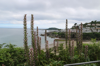
Lots of Bear's Breeches around at this time of the year, and most of them by the wayside and not in gardens. It's an entomophilous plant and it is pollinated only by bees or bumble bees large enough to force their way between the upper sepal and the lower, so that they can reach the nectar at the bottom of the tube. I find that fascinating. 
Looe: the end of this particular walk. We like Looe, even though it's full of tourists and has more than its quota of tacky shops. Despite these, it's still a nice place to walk around and savour the delights of a fishing village/town.
Where do we walk next? The map on the wall near our back door shows how much of the coastal footpath we've already covered - the bit we've just done is shown by the red box in the bottom right. We are getting there and, with a little determination, we should be able to complete the missing links this year. Our last stretch will be the one in North Cornwall that takes us to the border with Devon. After that, we'll turn around and start again!

Sunday 16 July 2017

With a little help from Photoshop

Over the years I've accumulated lots of old family photographs, the subjects of most of which are completely unknown. Why, oh, why, didn't people write names on the back of their photographs? One such is that above ostensibly from the Parsons side of the family. The original was very faded and the image a little unclear. But after a good digital wash and brush-up with Photoshop, what appears is a quite charming Victorian/Edwardian photograph of a woman and a child with a hoop. Is it my Great Aunty Minnie with one of her daughters? I don't think we'll ever know for sure but it is a poignant moment in time. Why I thought the image could be improved I don't really understand but I handed the digital file over to an acquaintance of mine (a certain Pierre-Auguste Renoir) who has a reputation as something of a colourist to see what he could do with it. This is what he came up with.
The result is quite cute but a little gaudy for my tastes. Renoir has added too much blue to her dress and has got rid of poor Great Aunt Min entirely! Amusing as it is, I can't see the colourful result standing the test of time. It looks more like a biscuit-tin than a serious attempt at photographic art. Merde, Photoshop has a lot to answer for.

Monday 10 July 2017

Walking in the neighbourhood

The weather continues warm and we took ourselves off for a walk from home. Just round and about to stretch the muscles and open up the airways. There's always something to see on your own doorsteps when you take the time to go and look.
Out of our front door, up our lane and then a right turn for a just under 4 mile circuit. The route took in quiet lanes, woodland footpaths, old miners' tracks, industrial archaeology sites and some far-reaching views. And a few inclines to get the hearts pumping. Lucky us.
The ivy-covered engine house and chimney of the Windsor Mine. This was consolidated a few years ago but it doesn't take long for the ivy to grow back and takeover. The roof is still reasonably intact but is now out-of-bounds to the casual walker. This mine was in operation from the mid-1800s until the very early 1900s. Copper, tin, arsenic, silver, lead - you name it, they went for it. Over the years, the many changes of ownership meant that the name changed and the type of minerals mined varied.
Just up the hill from the Windsor Mine are the remains of the Holmbush Mine, also know as the Hitchens' Shaft Complex. I've not been able to find out who Hitchens was and why he gave his name to a big hole in the ground. There are many mineral processing artifacts around these buildings and it is likely that ores from nearby smaller mines, like Windsor, were brought here for processing and purification. At its peak, there were over 100 men and boys working underground here, with an equivalent number working on the surface. As with most mines in the area, the Holmbush Mine has not been worked seriously since the late 1800s, although some of the spoil heaps have been reworked spasmodically over the years. To bring the story right up to date, an Australian company is currently doing some test drills to see if it is worth restarting mining in the area for Tungsten and whatever else makes it worth their while. It will be interesting to see how it all works out.

A field in South Coombeshead Lane. Although it takes a little imagination, there is a depression in the middle of this field which was caused by a RAF plane crashing there in 1941 with the loss of 4 lives.
This is a copy of the plaque to the four airmen which was place in Stoke Climsland Church a few years ago, in the presence of some members of two of the airmen's families. I was involved in the researches that revealed the personal details of the men and it still rankles that they were not listed on the plaque in alphabetical order, rather than in order of rank. One day, maybe, I'll give some more details about the men.
Stoke Climsland Church from near the site of the 'plane crash.
For many years the route from Callington to Launceston went through the centre of Stoke Climsland village and this milestone is alongside that old road However when the Callington Turnpike Trust was established in 1785 this road was bypassed in favour of the route taken by the present day A388 to Launceston via Wooda bridge and Treburley. I guess we people of Stoke Climsland should feel lucky that this two hundred year old bypass has left us with such a quiet village.

Friday 7 July 2017

A hot walk from Polruan to Polperro

What to do on a hot day? Take a strenuous walk along the Coastal Footpath, that's what. In retrospect, perhaps a cooler day would have been better but, nonetheless, it was a great day to be close to the sea. It was also quite an eventful day.
Our route: we parked at the top end of Polperro and caught a bus to Polruan where we joined the Coastal Footpath. At just under 7 miles, it was as up and downy (take a look at the elevation profile) as any walk we've done for a while. The path climbs and zig zags over cliffs and dips down to small rocky coves, providing fantastic scenery but challenging walking. 
Clear blue skies all the way around, with just a few clouds. 
Looking due west, the beacon tower on Gribbin Head can be made out. It was erected in 1832 to distinguish the Gribbin from Dodman Point and St Anthony's Head, and thus make navigation into the harbours of Fowey and St Austell Bay safer. It was never a lighthouse but is painted in broad red and white bands as a day mark. 
Looking down onto the sands and the blue sea at Lantic Bay. Looks positively tropical and it's a great shame that the water temperature will be anything but tropical.
Looking ahead of us eastwards with Lantic Bay and Pencarrow Point to the right. Lantic Bay is a relatively isolated spot and only the most determined will hike the 1/2 mile from the National Trust car park and then take the very steep path down to the beach. No facilities but just the spot for a relaxed day on the beach with few other people to bother you.


Ideal conditions for taking a ride in a boat with a powerful outboard and making pretty patterns in the sea.
About a mile inland from Lantivet Cove lies the church of St Ildierna in Lansallos. The present church may have replaced a Norman one built on the site of a Celtic “lan”, perhaps the hermitage of St Salwys after whom the village of Lansallos (Lan Salwys) is named. We didn't visit this time but we really must do a tour of the churches in the area, of which there are many, some with associations with Mrs P's forebears.
Another day mark for navigation, this one to help mariners find their way into Polperro Harbour. It's easy to forget that, until comparatively recently, a lot of coastal navigation was helped by what the sailors' could see, and hear. I wonder what they would make of today's GPS equipment.
 It was just after this point that our party of three deviated from our original plan, with a duo eventually ending up near Lansallos (curses upon farmers who prevent access to footpaths with barbed wire) and the other continuing on to Polperro to pick up the car.
One, just one, of the sets of steps going up, and down, the steep valleys punctuating the coastline. There is a technique for negotiating these - short steps with the feet planted firmly on the ground. The stability this gives is marginally easier on the leg muscles.
A male Stonechat. Lots of them around but this was the only one that perched long enough for me to get a photograph.
Every now and again the path goes through a tunnel of trees, mainly blackthorn, shaped by the wind. A welcome, but brief, respite from the sun.
Not quite at the end of the walk but Polperro Harbour comes into view as we come around the corner of Chapel Cliff. There was another 1/2 mile back up to our starting point in the Crumplehorn car park.


Wednesday 5 July 2017

O would some power the giftie gie us to see ourselves as others see us.

We see ourselves in two ways, and I'm thinking about our physical selves rather than the realms of psychological insight, either through the looking glass or in photographs. Through the looking glass is, like the world of Alice, strongly influenced by our imagination: how many of us go through a routine of squinting or posing in order to see ourselves in our perceived best way? Photographs, on the other hand, tell fewer lies. What you see is what you get. One hundred years or so ago there were a limited number of opportunities to be captured for posterity - the occasional trip to the local photography studio or a gathering of friends and family posing for the definitive group photograph. Once taken, that was it: that was the "you" that would be shared by friends and family across the generations. As an illustration, I give you two photographs from my family collection. Edwardian poses of my great great grandparents, Thomas and Harriet Boniface, and their eleven children on the occasion of their Golden Wedding in 1906. The family are captured for ever - complete with frowns and cares and unflattering angles. But that doesn't matter as the photographs represent a moment in history which is unique.
These days things are very different indeed. In the age of the selfie and costless digital photographs, we can sift and edit until we find the shot that best represents our imagined self. Selfie after selfie after selfie - selecting the ones we like best and deleting the rest. I am quite sure that the people in the Edwardian photograph would have liked such an opportunity to fine-tune their image, but they were stuck with the one take. Their consolation is that, over a century later, I am still able to revisit that day and these sepia photographs. Whereas most selfies are just digital ephemera and will be lost for ever in the blink of a SIM card.